Imagine a sudden burst of wind, so strong and fierce, sweeping across the land with astonishing speed. That’s a microburst—an extraordinary phenomenon in the world of weather that can cause a lot of trouble in just a few minutes. But what exactly is a microburst, and why does it happen? Let’s take a closer look at this fascinating aspect of nature and understand what makes it tick.
Understanding Microbursts:
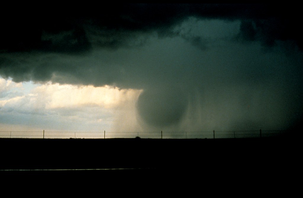
A microburst is like a strong wind that suddenly rushes down from a thunderstorm cloud to the ground. It’s like a big gust of wind, but much more powerful and happening very quickly. These bursts of wind are small and don’t last long, but they can be really strong, sometimes even stronger than the wind in a hurricane!
How Microbursts Form:
Microbursts usually happen inside big thunderstorms with a lot of rain and strong winds. Inside these storms, the rain or hail can cool the air down very quickly, and this cold air falls down to the ground fast. As it falls, it speeds up, and when it hits the ground, it spreads out in all directions, causing a big burst of wind.
Types of Microbursts:
There are two main types of microbursts: wet microbursts and dry microbursts.
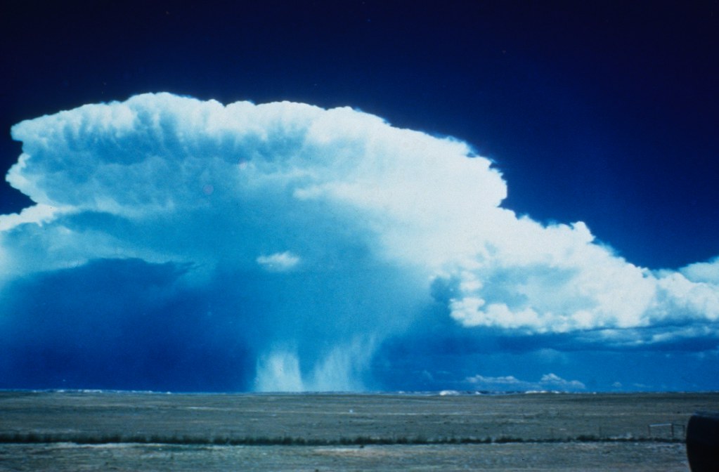
- Wet Microbursts: Wet microbursts occur when rain or melted hail falls through a layer of dry air beneath a thunderstorm cloud. As the precipitation evaporates in the dry air, it cools the surrounding air rapidly, leading to an increase in density and the formation of strong downdrafts. These downdrafts can descend to the ground with incredible force, generating powerful winds that spread out in all directions upon impact. Wet microbursts are often associated with heavy rainfall and can pose significant hazards to aviation, as sudden wind shifts and turbulence can catch pilots off guard during takeoff and landing.
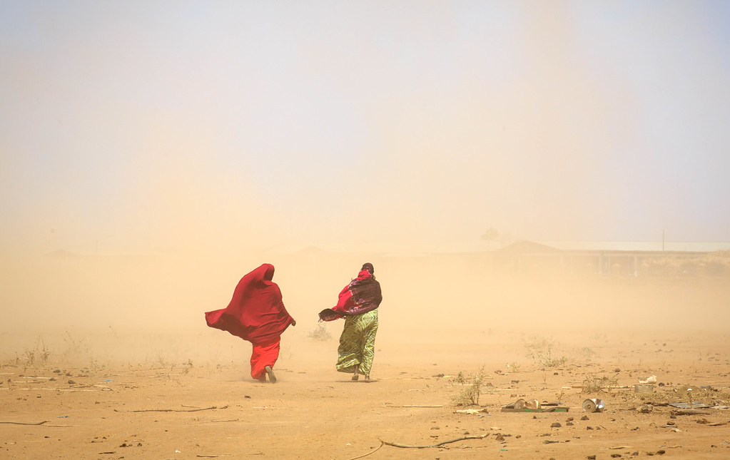
- Dry Microbursts: Dry microbursts, on the other hand, occur in environments where the air near the surface is already relatively dry. In these conditions, precipitation falling from a thunderstorm cloud encounters dry air below, leading to rapid evaporation of the rain or hail before reaching the ground. The process of evaporation causes the air to cool rapidly, resulting in a dense downdraft that descends to the ground with great speed. Dry microbursts are characterized by their lack of visible precipitation reaching the ground, making them more challenging to detect and predict compared to wet microbursts. However, they can still produce powerful winds capable of causing significant damage to structures and vegetation.
Impact of Microbursts:
- Structural Damage: Microbursts can cause significant damage to buildings, homes, and other structures due to their powerful winds. The sudden and intense gusts can exert tremendous force on rooftops, windows, and walls, leading to structural failures and property destruction. In extreme cases, entire roofs may be torn off, and buildings may collapse, posing serious risks to occupants and bystanders.
- Tree and Vegetation Damage: Trees and vegetation are particularly vulnerable to the force of microburst winds. The high-speed winds can uproot trees, snap branches, and strip foliage, resulting in widespread damage to forests, parks, and urban green spaces. The impact on vegetation not only disrupts ecosystems but also increases the risk of falling debris, endangering people and property below.
- Aviation Hazards: Microbursts pose significant hazards to aviation, particularly during takeoff and landing procedures. The sudden changes in wind speed and direction associated with microbursts can destabilize aircraft, causing loss of control and dangerous flight conditions. Pilots must contend with severe turbulence, wind shear, and rapid changes in airspeed, making microbursts one of the most challenging weather phenomena to navigate safely.
- Transportation Disruptions: Microbursts can disrupt various modes of transportation, including roadways, railways, and maritime routes. Fallen trees, debris, and structural damage can obstruct roadways and railways, impeding traffic flow and posing hazards to motorists and commuters. In coastal areas, microburst-induced windstorms can generate hazardous conditions for maritime vessels, complicating navigation and port operations.
- Economic Impact: The economic impact of microbursts can be substantial, encompassing property damage, infrastructure repairs, and business interruptions. The costs associated with restoring damaged buildings, clearing debris, and restoring transportation networks can place a significant burden on affected communities and municipal resources. Furthermore, disruptions to commercial activities and tourism may have long-term economic repercussions for local economies.
Mitigating the Impact:
Efforts to mitigate the impact of microbursts involve a combination of improved forecasting, public awareness, and infrastructure resilience measures. Advanced weather monitoring technologies, such as Doppler radar and satellite imagery, enable meteorologists to detect and track microburst activity more accurately, providing timely warnings to the public and aviation authorities. Building codes and construction standards can be enhanced to withstand the forces of microburst winds, reducing the vulnerability of structures and infrastructure to damage. Additionally, public education and preparedness initiatives play a crucial role in raising awareness of microburst hazards and promoting proactive measures to safeguard lives and property during severe weather events.
Spotting Microbursts:
Detecting and predicting microbursts pose considerable challenges to meteorologists and weather forecasters due to their localized nature and rapid formation. However, advances in weather monitoring technologies and observational techniques have improved our ability to identify the conditions conducive to microburst formation and provide timely warnings to mitigate their potential impact.
- Radar Detection: Doppler radar plays a crucial role in detecting and tracking microburst activity. Doppler radar systems can detect changes in wind speed and direction within thunderstorms, providing meteorologists with valuable data on the presence and intensity of downdrafts associated with microbursts. By analyzing radar imagery and velocity patterns, forecasters can identify potential microburst signatures, such as radial outflows and divergence patterns, indicative of strong downdrafts.
- Satellite and Remote Sensing: Satellite imagery and remote sensing technologies offer valuable insights into atmospheric conditions conducive to microburst development. By monitoring cloud patterns, temperature gradients, and moisture levels, satellites can detect the formation of thunderstorm cells and assess the likelihood of microburst activity within a given area. Additionally, ground-based sensors and weather stations provide real-time data on wind speed, temperature, and humidity, aiding in the identification of microburst-prone regions.
- Visual Observations: Visual observations by trained spotters and weather observers play a critical role in spotting microbursts, especially in areas where radar coverage may be limited. Spotters stationed at airports, weather stations, and observation posts are trained to recognize the visual cues associated with microburst formation, such as rapid changes in cloud structure, gusty winds, and sudden shifts in atmospheric pressure. By reporting their observations to meteorological agencies and air traffic control centers, spotters help disseminate timely warnings and ensure the safety of aviation operations.
- Microburst Prediction Models: Numerical weather prediction models utilize sophisticated algorithms and computational techniques to simulate atmospheric processes and forecast microburst activity. These models analyze a wide range of meteorological variables, including temperature, humidity, wind shear, and instability, to assess the potential for microburst formation within a given time frame and geographic area. By integrating observational data with model outputs, forecasters can generate probabilistic forecasts and issue targeted advisories to stakeholders, including pilots, air traffic controllers, and emergency responders.
Conclusion:
Microbursts might be small, but they’re mighty! Understanding how they form and knowing what to look out for can help us stay safe when the wind suddenly picks up.
You May Also Like

